

Well, not really. I just found this interesting and decided to take the time to see if anyone else felt the same. This is a dozen or so of my rides that I have recorded over time over-layed on Google Earth creating a picture of MOST of what I've ridden down there. When I say most I mean most because while I have ridden it several times, I have not recorded the South Trace from the Middlefork connection down to its end. That end not being the end of the Ozark Trail, but the end of mountain bike use, hence the creation of Middlefork. Middlefork allows all users to continue on with the flowy goodness of Mark Twain National Forest single track.
This map begins at the north only a handful of miles from the actual northern most point of the OT. Unfortunately, bikes are not allowed beyond this point on my map. In fact, I think we went just past the official Narrows trail head where you can access the Courtois section and begin riding south. It was a jeep trail but we did see the Huzzah signs which, I believe is where bike use ends. We rode in from Bass' River Resort and turned around to ride back.
From there to the southern end of my map is about 91 miles of single track, one way. Also in the top part of the map are the gravel roads used in the Berryman Trail Epic which can be used to bypass any or all of the single track between Bass' and Berryman. This section also contains the newest trail in the OT system.
After what I would call the first two "loops" when starting from the top, you make it to the Berryman. Only the west side of Berryman shares the dirt with the OT, but I thought the entire loop should be included. At this resolution, Berryman looks like one small loop and one very large loop when in fact it is one ginormous loop, 24ish miles to be exact.
Just below is another good sized loop that shows the OT on the left and a gravel return on the right. Under that, are two very small and one slightly larger loop which are all part of that gravel return. The OT only crosses the gravel two times here, but again at this resolution it looks like more.
From there it's all single track for a while, finishing the Courtois(Code-away) section at Hazel Creek camp ground and moving on to the Trace which is divided into a north and south section. North Trace ends at hwy DD where you have one mile until you reach the 1/4 mile long Tellock Connector(GORC had much to do with this re-route) which takes you over to Council Bluff Lake. A 12.5 mile loop around the lake with a 1/2 mile option up to the campground is in there. From the junction of South Trace and the Tellock, you keep going for a mile or so to the Middlefork fork. To its end, Middlefork is 24 miles. There is a large loop and a small loop in this section. These are the gravel returns that some like to use, I prefer the trail.
Just below the small loop is the start of the Karkaghne(Car-kag-knee), a 29 mile section and my newest addition to my map collection. The very bottom of my map is still about 14 miles short of completing this section so I have work to do.

While you can order up copies of any and all of these maps, these are my experiences. I've ridden all of this, in many cases LOTS of times. In some, only once. 117 miles of single track and 35 or so of gravel, it's a ton of fun. All of this within two hours of St. Louis and a ton of camp grounds available as well as camping on the trail itself. Beyond the south end of the Karkaghne is much more trail to be "mapped".
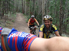
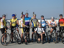
When I say they are my experiences, I really mean they are experiences I've had with friends. Some in races, others in non-races but all just riding to have fun. These are some of the Jerks that helped me create this collection.
Todd Hecht
Greg Ott
Jeremy Bock
Matt Grothoff
Dwayne Goscinski
Chris Ploch
John Pieffer
Nate Means +1?
Mike Best
Doug Davis


No comments:
Post a Comment